
Seeing the relationships across our region.
Interactive maps have been a hallmark of the Long Island Index, enabling Long Islanders to actively engage in considering specific findings and to tailor their consideration to their own circumstances. The key interactive maps are the following:
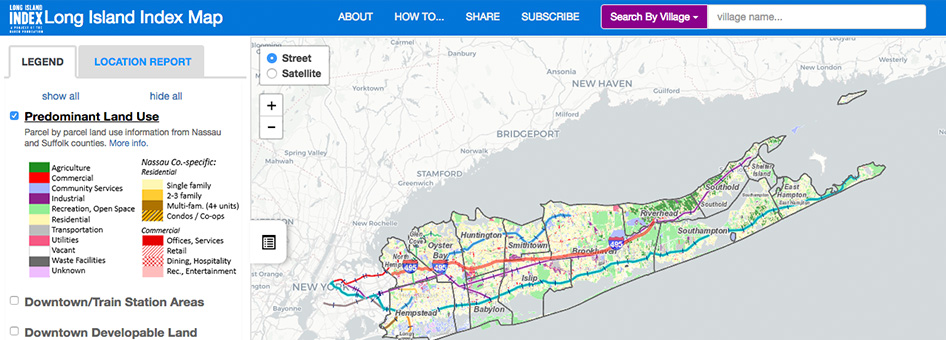
Long Island Index Maps
The Long Island Index launched a set of interactive maps that enables Long Islanders to easily access an extraordinary array of data about our region and its communities. The map provides a wealth of information about the region, its characteristics, and key indicators – as well as its individual communities and their attributes. Maps of Long Island’s Special Districts and Multifamily Housing have also been integrated into these new maps rather than being a standalone system. LAUNCH MAP
Historic Census Maps
A separate section of our interactive maps collection shows almost 50 years of demographic transformation across Long Island. LAUNCH MAP